
Satellite Image Analysis Powered by AWS
Ministry of Works, Municipalities Affairs and Urban Planning launches the first satellite imaging system for green areas detection in partnership with AWS
Manama, Kingdom of Bahrain, September 1st, 2020
The Ministry of Works, Municipalities Affairs and Urban Planning is a government body established to respond to the needs of the Bahraini society and enhance Bahrain’s economy by placing effective policies and regulations for urban planning. One of their responsibilities is planting and protecting trees in the streets of Bahrain and ensuring that all planted areas on sidewalks outside a private property, have been issued a permit and are well taken care of.
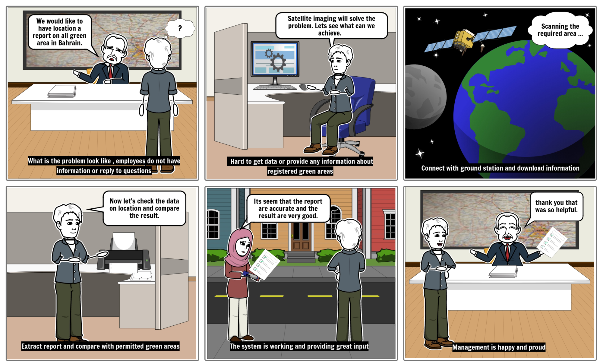
The Ministry of Works, Municipalities Affairs and Urban Planning has been struggling with identifying the non-permitted planted areas all around Bahrain and has attempted to carry out several plans of action to eliminate this problem. The current system is outdated, manpower exhaustive and cost and time consuming.
Amazon Web Services (AWS) and Cloud Innovation Center at Bahrain Polytechnic teamed with Ministry of Works to create a platform for satellite images to be used for green areas plantation detection. Launching the system ‘Arduna’ to visualize the detected green areas in a dashboard. The name ‘Arduna’ is inspired by the Arabic word for ‘our land’. It reflects commitment and loyalty towards an environmentally friendly society. Developing the solution allowed the students to tap into new technologies and utilize the AWS cloud services. This great opportunity will build a generation of university graduates that delve into the new era of innovative technologies.
The solution is about developing a dashboard that displays a map of Bahrain with all green areas marked permitted/non-permitted using satellite imagery for up-to-date green area detection and identify the permitted areas from the non-permitted. Arduna follows a serverless event-driven architecture that consists of three backend subsequent processes. The satellite imagery dataset is retrieved on a monthly basis using a CloudWatch event rule and stored in an AWS S3 bucket to ensure up-to-date information. Then, the green area detection process triggers an AWS Lambda Function, which uses Computer Vision algorithms to analyze the uploaded images and return pixel coordinates of detected green areas. Pixel coordinates are then converted into geographical coordinates using custom mathematical algorithms and uploaded into a DynamoDB table. Finally, the system classifies the detected green areas into permitted or non-permitted and saves the outcome in a result DynamoDB table. The table is then accessed by the frontend using a REST API and visualized on an embedded map in the dashboard. The dashboard also allows citizens to request a permit for green area plantation to be approved by the Ministry of Works and external entities.
The system has simplified the process of detecting violations by lowering the time needed to detect green areas, reducing the cost, and minimizing the need for work force. Arduna has eliminated the need for citizens to visit the ministry on-premises to request a planting permit by offering a readily available digital service.
“I’m impressed with the use of technology to solve real world problems and how Bahraini students are leading innovation not only in Bahrain but also in the region and the world. This was a fruitful collaboration with Bahrain Polytechnic in the cloud innovation center,” said Ben Butler, Global innovation Centers leader at AWS.
” A great opportunity and impressive efforts to leverage the partnership between Governmental sectors, Private sectors and Education all together. An initiative that truly translates his Majesty King Hamad Bin Isa Al Khalifa, The King of Bahrain declaration during the second session of the fifth legislative term of the Shura and Representatives Council on October 13, 2019 regarding the adoption and implementation of artificial intelligence techniques in the production and service sectors and aligned with the vision of the Kingdom of Bahrain 2030 and the government action plan 2019-2022. I would like to take the chance to express our real appreciation for the tremendous efforts, creativity and innovation spirit; the keys for making great ideas become a reality”, said Mohamed Abu Hassan, Assistant Undersecretary for Resources and Information – Ministry of Woks, Municipalities Affairs and Urban Planning.
“On behalf of the Ministry, I would like to thank each and every one of the team members from AWS CIC and Bahrain Polytechnic and I am certain that this shall only be the start and that more brilliant ideas still to come, and for the students, the new faces of transformation, sincere wishes of successful future and prosperity”, he added.
Ground Station in Visuals
Have a look at how Ground Station should work
Customer FAQ
Most frequent questions and answers
Once a month
$100 per month
Yes, the code will be published in GitHub
The development is the responsibility of the CIC, and the operation will be managed by the client
There will be a demo for the client
Create an API to the Municipality database
Based on the evaluations, the model provides accurate results.
Stakeholders FAQ
Most frequent questions and answers
Bahrain Polytechnic
A prototype

Contacts
For more information
Ministry of Works, Municipalities Affairs and Urban Planning
Oun Mohammed Ebrahim – Sr. Computer Application Specialist
amebrahim@MUN.GOV.BH
Amazon Web Services
Nidal AlBasha – Senior Digital Innovation Lead, MEA
nidbasha@amazon.com
Bahrain Polytechnic (CIC) Team
Copyright 2023 Bahrain Polytechnic CIC. All Right Reserved.